Progress: Difference between revisions
From Dragon Eye Atlas
No edit summary |
No edit summary |
||
| Line 3: | Line 3: | ||
* {{NUMBEROFARTICLES}} articles in this Wiki | * {{NUMBEROFARTICLES}} articles in this Wiki | ||
* [[Special:RecentChanges|Recent Changes]] | * [[Special:RecentChanges|Recent Changes]] | ||
== 2019/09 - Map Integration == | |||
Thanks to Mapbox, I've managed to integrate my map into the wiki and styled it more or less beautifully (I'm not an artist). For the integration, the Mediawiki extension Widgets proved the most useful, much more so than the various dedicated maps extensions, which make it so much more difficult to use your own map source. | |||
Revision as of 05:40, 22 September 2019
Summary
- 571 articles in this Wiki
- Recent Changes
2019/09 - Map Integration
Thanks to Mapbox, I've managed to integrate my map into the wiki and styled it more or less beautifully (I'm not an artist). For the integration, the Mediawiki extension Widgets proved the most useful, much more so than the various dedicated maps extensions, which make it so much more difficult to use your own map source.
2019/09 - Basic Technology
Figured out how to export map data from Azgaar's Fantasy Map Generator, wrote the code to do it and added it to the generator with a successful pull request.
Mostly figured out how to do the same with Watabou's Medieval Fantasy City Generator, but this time using his SVG export directly without changes to the upstream code.
Figured out how to use the Mediawiki Maps extension to show maps inside the Wiki, with highlighting via the GeoJSON namespace. A few pages created already, but they are overlayed over a map of the real world, not my fantasy world. Still trying to figure out how to teach Leaflet to use a different data source.
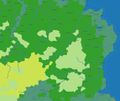
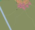
Imported everything into QGIS and started working on it. It's still a far cry from the sheer beauty of Azgaar's Generator, but I'm getting there. Here are some screenshots from my current status:
-
first QGIS experiments
-
city in QGIS
-
map overview
At the moment working on bringing all that mapping data unto the web, experimenting with qgis_mapserv, tilecache and geoserver and trying to customize leaflet to my needs.
Time Parameter
Little known is that GIS also supports temporal extents, so data can be located in time as well as space - something that can be so interesting for historic maps and "scrolling through time".


