Geographic Maps: Difference between revisions
From Dragon Eye Atlas
No edit summary |
No edit summary |
||
| Line 13: | Line 13: | ||
== | == Geographic Map == | ||
[[File:Geography map.png|center|geographic map]] | |||
[[File:Geography map.png| | |||
Revision as of 10:46, 31 January 2021
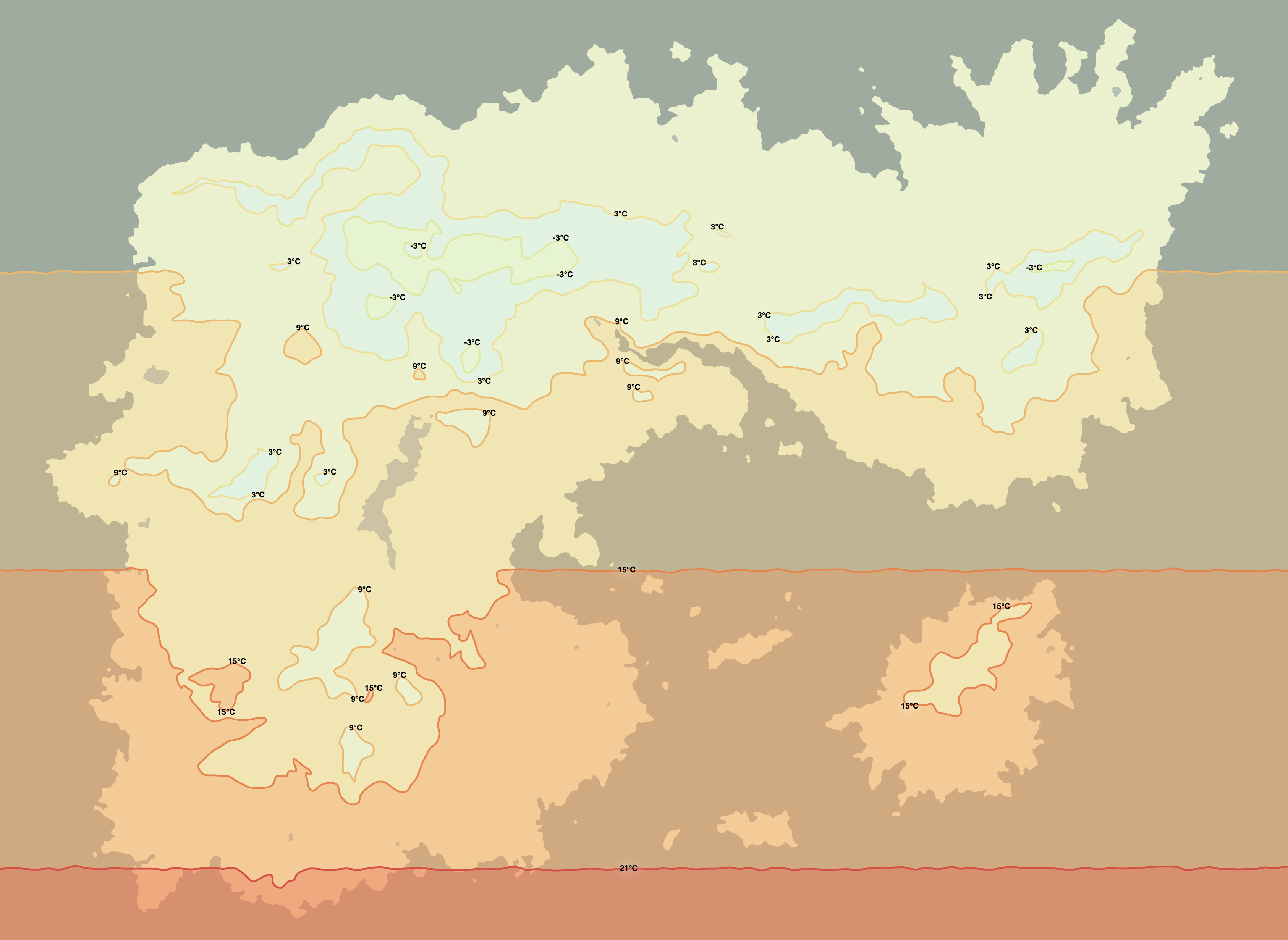
Average Yearly Temperatures

Shown above are the average yearly temperatures in Auseka.
Areas above 21°C are tropical and warm throughout the year. In the 15°C region is a subtropical climate. The 9°C regions are the warmer temperate zone, mediteranean climate (or southern USA). The 3°C is the colder temperate zone, northern Europe or northern USA climate with warm summers and cold winters. Snowfall is common there, while it does happen in the 9°C warmer zone where some winters are cold and some are warm. There is no polar climate zone in Auseka, though many of the higher altitude regions are in the -3°C average temperature zone and are cold through the year with long and cold winters. A few of the very high mountains are frozen throughout the year with average temperaturs -9°C as below, but these places are also barren, largely above the tree line and cold due to altitude, not climate zone.
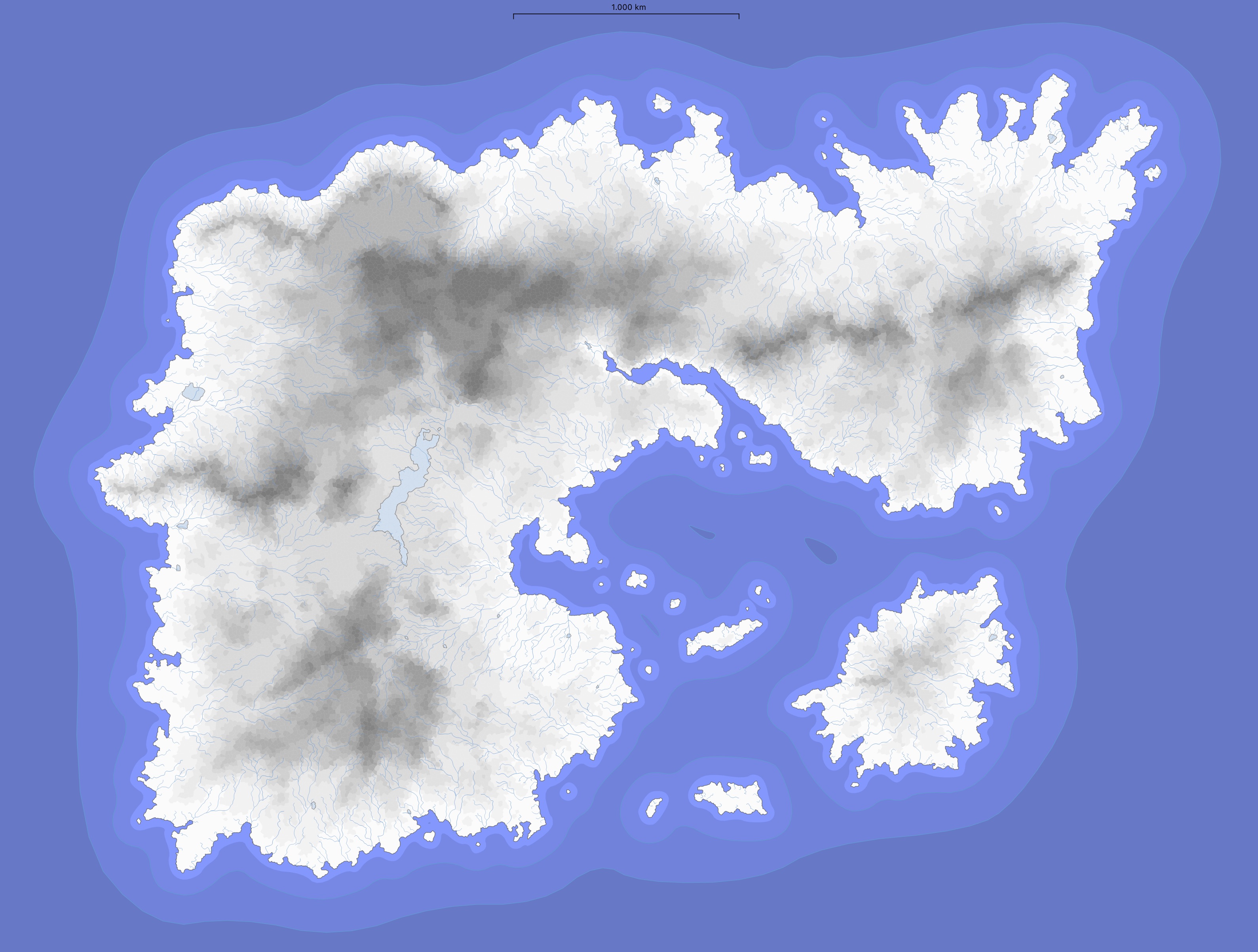
Heightmap

Highlands and mountain ranges of Auseka.
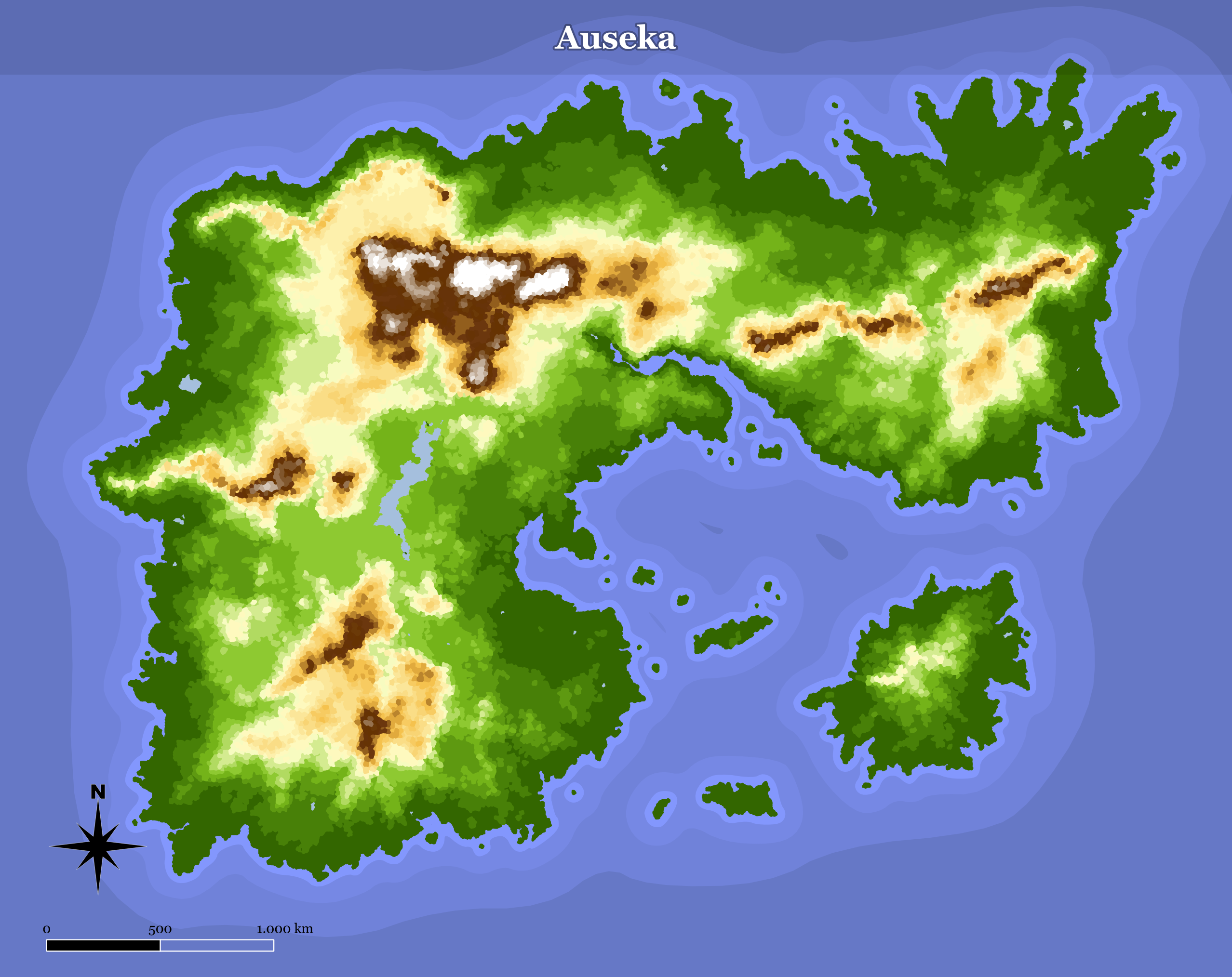
Geographic Map
